Europe with Ali Part IV: Plitvice Lakes in Croatia, and the trip home

Alison kept telling me how exceptional Croatia was, so she wanted to drive me to Plitvice Lakes National Park, where a bulk of the groundwater that flows through the Alps dumps out. That is a lot of water, since there is so much snowmelt and there are so many limestones with caves (as we saw in Austria). On the way from her house to Plitvice, we were going to get pretty close to the ocean, so I wanted to check that out, at least for a little bit. I found a small rocky cove written up online in Rijeka, so we stopped, walked into the crystal clear water, and found some anemones living on the rocks. Then, we sat on the beach for a while, looking at the lovely pebbles and found many with beautiful fossils, such as foraminifera! It was time well wasted, but we had to get on to our destination. At one point on the drive, pretty close to Plitvice Lakes, I spotted this waterfall and asked Ali to pull over, so I could photograph it. She humored me, knowing what was to come as I was tried to read her happily smug expression.

We made it to the hotel late, but I woke up excited to see what the fuss was all about. The multilingual lady at the hotel gave us a rundown of the park and a plan that she said would take 4 hours. We were some of the first people in the park and headed out on our journey. The planning and infrastructure of the park and walkways was very well done. This part of the walk had crystal clear spring water flowing under the walkways, but no major waterfalls were in view yet. There were some other tourists who thought it odd that we were stopping to take photos and videos (some underwater), but they obviously have not met our husbands, who would have had to camp out in this park for a week.


Then, we walked down some wooden stairways flanked by waterfalls underneath and on both sides, feeling like we were part of the flow. At that point, the path meandered and then opened up to the largest waterfall we would see all day!


After an hour of getting the perfect shot of that waterfall, we moved along to find one....after another.....after another.....after another. This place was insane!

At one point, we caught a park boat across one of the many lakes to get to the other side, where there were many other lakes, pools, and waterfalls. Some of these lake are very deep, up to 150 feet, but I will explain that a bit later. The elevation drop is high between all of these lakes, so that is the other reason there are so many rushing waterfalls, rather than just streams.

The water was so clear and often had a turquoise hue due to the tufa and carbonate sediment at the bottom. The next photo is not edited at all, to show you the color. We also saw many fish and crawdads in the water, including a pike!


When we got off of the boat, we found ourselves in Neverland, the land of never-ending waterfall splendor!


The next photo captures the essence of this place perfectly. The way that the walkways were built into the waterfalls themselves really helped the visitors feel as if they were part of it.


If you have a keen geological eye, you may have noticed tufa (such as dripstones) in the previous images. Tufa is a type of limestone that is usually white, yellowish-orange, or grey, but is often covered by algae and plants in this lush place. Just like the formations inside of a cave, these limestone rocks get deposited due to lots of calcium carbonate in the waters. The waters of Plitvice Lakes have been picking up calcium carbonate as they flowed through the Alps underground (such as in the caves we explored in Austria). Now, these waters are spilling out and (with the help of the lush plants, algae, and microbes) the calcium carbonate is being deposited. The next image shows how quickly the travertine can coat everything, as it is coating the branches that are underwater. We even saw branches of living trees and and stems of small plants that were already coated in the calcium carbonate minerals.


You may be wondering how these waterfalls can be seemingly coming from out of nowhere, cascading from a tower. That is because the waterfalls built the tower! Anywhere that the water is flowing, it can deposit minerals, so the regions where water is flowing downhill (as water does) from one lake to another, are being built up. So, these waterfalls are actually growing upwards overtime, seemingly defying gravity! The connections between lakes and pools are becoming steeper and steeper, so the lakes are getting deeper and the waterfalls are getting taller!


Eventually, though, the water will find an alternate path from one lake to another, as water does not really defy gravity. So, this tufa tower will become abandoned and the water will flow around it. It is only the lowest point for so long, since the minerals are building up. Then, this tufa tower will become part of the landscape and get covered with soil and lost among the vegetation. We saw many such formations on our hike, that may have been waterfalls as recently as last year.


We were having such an excellent time that we wanted to see it all and our "4-hour plan" turned into the entire day. We had hiked several miles north from our original spot and were hoping to catch a park shuttle back towards where we had started and then realized we were closing the park down! The numbers of tourists had dwindled throughout the day, so it seemed like we were alone in Neverland. We hiked quicker and kept expecting to find the end of the trail, where the bus stop was. We actually started to exclaim in equal parts joy, amazement, and frustration, "Another waterfall?!?!?!?!", as we would round a turn and realize that we were not near the end. At one point, we started to jog and ran into a lone German guy, who was also hoofing it. We reached the shuttle station and waited about 10 minutes, but a bus did arrive- whew! Then, Alison bravely drove us 6 hours back home, since my flight was the next day. At the end of the night, we were constantly putting on our favorite songs and singing to stay alert. Word to the wise: spend more than one night in Croatia....you will not regret it!
We both slept like rocks that night. Somehow Alison managed to wake up in time to go to her favorite local bakery before I got up, so this is what I woke up to! And, she got some chocolates for me to take home to John. A final sweet taste of Italy!

After a bittersweet goodbye (and Alison having lunch with me in the Venice airport), I boarded my plane to head back home. I love how airplanes have route maps now. Ever since I was a kid, I have been staring out the window, wondering what I was passing over. I can't believe how many people take this for granted and really don't care. I noticed on this route map that we might fly over the tip of Greenland in the daytime, so I was determined to stay up for the entire 9-hour flight. I watched my favorite movies and checked out the window frequently. Finally, some tiny white shapes started appearing in the navy blue ocean-- ice bergs! We must be getting close!
Here is the map as we approached Greenland.

There it is- the frozen subcontinent with the largest glaciers in the world! I was glued to my window.

We flew over more of Greenland than I thought we would. Here the HUGE mountains, the size of the Alps, are sticking up through the clouds.

The smooth, perfectly white regions in the next two photos are part of the continental ice sheet that covers almost all of Greenland. It is made of glaciers and has white snow covering most of its surface. The glaciers wrap around and flow around the tips of these massive mountains. This gives some perspective to how thick this ice is. This was only a few miles from the coastline, so it's amazing to me that the ice is already this thick, so close to the glaciers' edges.

At the bottom of the next photo, you can even see some crevasses, huge cracks in the glacial ice.

After flying over the ice sheet and mountains, the other coastline opened up as a series of islands with bands of icebergs that had broken off of the glaciers' edges.

I saw on the map that we were also going to fly over "Iceberg Alley" and Newfoundland & Labrador, so I stayed awake. After about an hour, the amount of white flecks increased dramatically and I realized that it must be sea ice floating down from the Arctic. The patterns that the currents swept the sea ice into reminded me of ooid shoals in the Bahamas- beautiful!
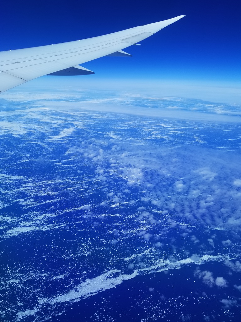
Then, it started getting real really quickly! Look at the size of these sea ice chunks! They are the size on entire towns.


Then, the jagged coastline of Labrador came into view (left in the next photo).


I have never seen rock folds like these I flew over in Labrador. They may have been the bases of mountains that were flattened by the bulldozing power of glaciers during the last ice age.


What a spectacular end to a spectacular trip. Thank you for the most magical geologic friendship tour of Europe, Ali!


Comments
Post a Comment